Tombstone Territorial Park
Tombstone Territorial Park
In northern Yukon, Tombstone Territorial Park sprawls across 2,200 km² of tundra and jagged peaks, accessible from Dawson City via the Dempster Highway.
Tombstone Territorial Park covers 2,200 square kilometers in northern Yukon, approximately 1.5 hours by road from Dawson City. Jagged peaks, Arctic tundra and alpine meadows make up a wild territory co-managed by the Tr'ondëk Hwëch'in First Nation and the territorial government, accessible only via the Dempster Highway.
Why visit Tombstone Territorial Park
The park concentrates a rare mosaic of ecosystems for these latitudes: boreal forest in the valleys, alpine tundra on the summits, permafrost formations and glacial lakes. The transition from one environment to another can be observed within a few hours of hiking. The Tr'ondëk Hwëch'in named this territory Ddhäl Ch'è Cha Nän, meaning "jagged mountainous land," an expression that faithfully describes the sharp ridges of the Ogilvie Mountains and the Blackstone highlands.
For those seeking uncrowded wilderness, challenging trails and subarctic landscapes, this is one of the most striking stops in Canada's far north.
Park history and Indigenous co-management
Early conservation efforts date back to 1972, when scientists identified two sensitive sites in the region. In 1974, the Department of Indian Affairs and Northern Development designated an area for protection in connection with the construction of the Dempster Highway, to preserve the surroundings of Mount Tombstone.
The park was officially established in 2000, following directly from the Tr'ondëk Hwëch'in land claims agreement signed in 1998. It lies entirely within the traditional territory of this First Nation, which co-administers it with the Yukon government. Ancestral cultural and hunting practices remain at the heart of site management.
What to see and do
Wildlife and birds
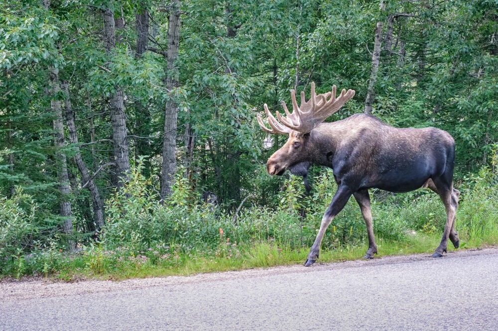
The park is home to several large mammal species: grizzly bears, black bears, caribou, moose, Dall sheep and wolves. Among smaller mammals, you'll encounter Rocky Mountain marmots, collared pikas and red foxes. Nearly 150 bird species have been recorded, including:
- the gyrfalcon, the world's largest falcon, observable soaring above the ridges;
- the golden eagle, present in rocky areas and valleys;
- the willow ptarmigan, an emblematic tundra species.
Several insect species endemic to Beringia complete this biological picture: they are found nowhere else on the planet.
Day hikes
Most short trails depart from the interpretation center, accessible from the Dempster Highway. Three itineraries stand out:
- Goldensides (4 km): well-marked ridge on easy terrain, 360° panorama of Tombstone Peak, Mount Chester Henderson and Mount Monolith.
- Grizzly Creek (3 km): mature boreal forest then steep ascent to the Mount Monolith viewpoint. More demanding terrain, good fitness required.
- North Klondike River (1.6 km): the least demanding trail, through deciduous forest then birch thickets, with open views of the summits.
Multi-day treks
The Grizzly, Divide and Talus Lakes loop is Tombstone's signature itinerary: 3 to 5 days, over 55 km, positive elevation gain exceeding 1,200 meters, through boreal forests, alpine cirques and tundra. Each of the three lakes has a backcountry campsite with ten tent spots, dry toilets, cook shelter and picnic table. Camping permit and online reservation are mandatory before departure.
Winter activities
Tourist facilities close in winter, but the park remains accessible via the Dempster Highway for backcountry skiing and snowshoeing, from mid-autumn through early spring. Complete self-sufficiency is required.
When to visit
The main season runs from mid-May to mid-September, when the interpretation center and campsites are open.
- July to August: peak season, long days ideal for hiking. Book backcountry campsites well in advance.
- Late August to early September: fall colors on the tundra, wild berries, first northern lights dancing above the peaks.
- October to April: facilities closed, access only for self-sufficient travelers equipped for ski or snowshoe (subarctic conditions).
How to get there
The park is accessible only via the Dempster Highway, 737 kilometers of gravel road passable much of the year—weather permitting, as conditions can make the road difficult or even closed in winter. The interpretation center is located at kilometer 71.5, 56 km north of Dawson City.
- From Dawson City: approximately 1.5 hours. Take the North Klondike Road, then the Dempster to the interpretation center on the left.
- From Whitehorse: approximately 7 hours by road.
- From Inuvik (Northwest Territories): approximately 12 hours by road.
Plan for food, fuel and at least one spare tire. A card-only gas station is available at the Dempster junction; the next service is at Eagle Plains, several hundred kilometers further north.
Practical information
- Interpretation center: open mid-May to mid-September. Exhibits, maps, interpretation programs, guided hikes and campfires. Mandatory starting point for any backcountry camping.
- Permit and reservation: mandatory for the three backcountry campsites, to be reserved online before departure.
- Cell service: no cellular coverage in the park. Nearest lodging and restaurants in Dawson City.
- Bear safety: remote terrain, changeable weather. Briefing at the interpretation center recommended. Bear spray can be borrowed free of charge at the Dawson City visitor information center.
- Accessibility: accessible washrooms for people with reduced mobility at the interpretation center.
Nearby
Dawson City is the natural logistics hub for visiting Tombstone: fuel, lodging, restaurants, equipment rental and visitor information center. Further along the Dempster, Eagle Plains is the only service point before crossing the Arctic Circle. To extend your experience of Canada's great parks, sites like Banff National Park or Gros Morne National Park offer other facets of the country's protected landscapes.
Frequently asked questions
Planning your Yukon trip
Tombstone fits naturally into a broader itinerary spanning Dawson City, the Dempster Highway and Canada's far north landscapes. To build a custom trip including the park and surroundings, explore our Canada tours.
Interested in this visit?
We can include it in your personalised itinerary.